
🇬🇧 – 🇮🇹
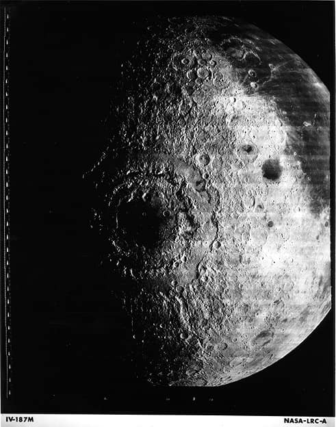
In 1967, the lunar satellite Lunar Orbiter 4 entered the orbit of the Moon and began taking photographs three days later
Nel 1967 il satellite lunare Lunar Orbiter 4 si inserisce nell’orbita della Luna e tre giorni dopo inizia le riprese fotografiche
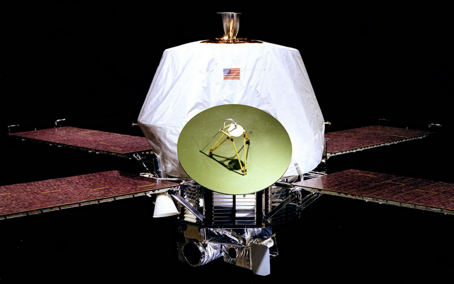
In 1971 NASA launches the Mariner 8 probe with the Atlas-Centaur SLV-3C rocket (see photo) with the aim of reaching the orbit of Mars but the launch fails and falls into the Atlantic Ocean
Nel 1971 la NASA lancia la sonda Mariner 8 con con il razzo Atlas-Centaur SLV-3C (vedi foto) con lo scopo di raggiungere l’orbita di Marte ma il lancio fallisce e cade nell’oceano Atlantico

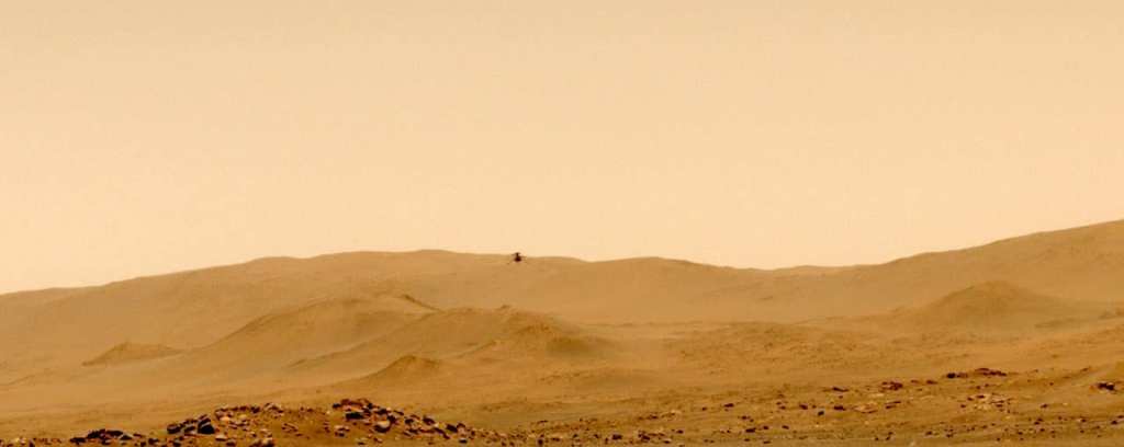
At 01:31 in 2021 was the fifth flight of the Ingenuity helicopter to Mars (see photo above) with its first one-way trip from Wright Brothers Field to an airfield 129 meters to the south. Upon arriving above its new airfield, Ingenuity climbed up to 10 meters and captured high-resolution color images of its new base before landing. Among its objectives: aerial observations of areas not accessible by a rover and detailed stereo images from atmospheric altitudes. The flight started at 15:26. EDT (12:26 pm PDT, 12:33 pm Mars local time) and lasted 108 seconds. The Ingenuity team chose the new landing site based on information gathered during the previous flight – the first “aerial survey” operation on another world – which allowed them to generate digital elevation maps indicating almost completely flat terrain almost without obstacles. Videos: https://youtu.be/PFbzEM8PzHE…
At 01:31 in 2021 was the fifth flight of the Ingenuity helicopter to Mars (see photo above) with its first one-way trip from Wright Brothers Field to an airfield 129 meters to the south. Upon arriving above its new airfield, Ingenuity climbed up to 10 meters and captured high-res color images of its new base before landing. Among its objectives: aerial observations of areas not accessible by a rover and detailed stereo images from atmospheric altitudes. The flight started at 15:26. EDT (12:26 pm PDT, 12:33 pm Mars local time) and lasted 108 seconds. The Ingenuity team chose the new landing site based on information gathered during the previous flight – the first “aerial survey” operation on another world – which allowed them to generate digital elevation maps indicating almost completely flat terrain almost without obstacles. Videos: https://youtu.be/PFbzEM8PzHE…
Text source: Wikipedia, Nasa
Images credits Nasa / Esa Hubble telescope


